Sultan Ibrahim ibn Adham Mosque
مسجد السلطان إبراهيم بن أدهم
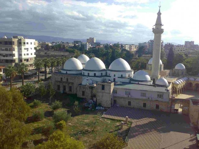
A mosque and shrine in Jableh linked to the ascetic Ibrahim ibn Adham, built over a Seljuk-era shrine, its prayer hall completed by the Mamluks and its domes added by the Ottomans.
The Mosque of Sultan Ibrahim ibn Adham in the coastal city of Jableh is a Sunni mosque and mausoleum. Its oldest part dates from the Seljuk era, and it was improved by the Mamluks and Ottomans, whose contributions still dominate the building today.
It is named after Ibrahim ibn Adham, an 8th-century Sufi mystic and Islamic scholar who is said to be buried in its shrine. Tradition holds that he died on a naval campaign against the Byzantines and was buried in a fort on a Roman island, which is claimed to have stood where Jableh is now; other places also claim his grave, so the attribution is best read as inherited tradition.
A church once stood on the site and was demolished. The first structure over the grave was a shrine completed by the Seljuks as a mark of respect for the Sufi saint. Under the Mamluks a mosque with a minaret was attached to the shrine, a fountain and gate were added, and the present prayer hall was completed. Under the Ottomans the mosque's domes were built and the minaret renovated.
The mosque has three perpendicular entrances: a northern one leading to the open courtyard, a southern one to the shrine, and an eastern one to a row of warehouses. The complex consists of the prayer hall, the courtyard and the shrine room. The Mamluk prayer hall has walls about 116 centimetres thick and a minbar of white-grey marble, with the mihrab on the south side. The shrine room is roughly square, its walls at least eight metres long, topped by a dome of Syrian sandstone on an octagonal base; in its south wall is an old semicircular mihrab, and Ibrahim ibn Adham's grave lies at the centre. A hammam with a fine marble floor is attached.
Standing near the Roman theatre in old Jableh, it lets a visitor take in two layers of the city's history in one walk.
Note: photos may not reflect the site's current condition.
For the visitor
Location: 35.3629, 35.9241 · Open on the map
Photos: Free Syrian 200 — via Wikimedia Commons (CC BY-SA)
Syria Trails — An interactive geographic and heritage atlas of Syria: a map that walks down from the country to the district, landmarks with their story and era, curated trails and a passport for your visits.