Palmyra
تدمر
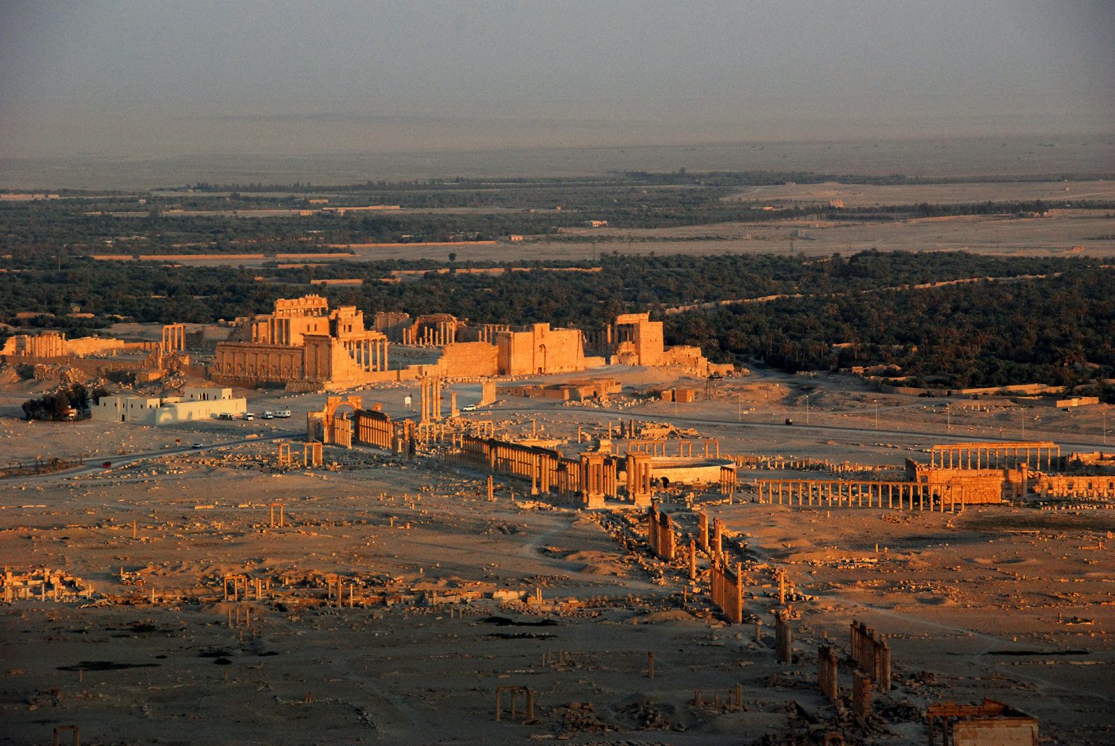
A Roman-era caravan city that grew wealthy taxing trade routes between the Near East and Rome, reaching its peak under Queen Zenobia in the 3rd century CE.
Palmyra is an ancient city set in an oasis in the middle of the Syrian steppe. The earliest references to it date back to the second millennium BCE, though most of the monumental architecture visible today was built in the 1st to 3rd centuries CE, under Roman rule.
The city grew wealthy from its position on the caravan routes linking Persia, India, and China with the Roman Empire, taxing the trade that passed through it. That wealth funded a distinctive monumental style blending Roman, Persian, and local traditions — most famously the Temple of Bel, the Great Colonnade, the Monumental Arch, and the Valley of the Tombs with its funerary towers.
Palmyra reached the height of its political power under Queen Zenobia in the 260s and 270s CE, when she expanded the short-lived Palmyrene Empire to include Egypt and parts of Anatolia, before the Roman emperor Aurelian defeated her and sacked the city in 272 CE. Palmyra continued through the Byzantine and Umayyad periods, and a hilltop fortress overlooking the ruins — known as Palmyra Castle — was later built, with a core dating to the medieval period.
Its ancient name, Tadmor, goes back to Aramaean times, and its people spoke Palmyrene Aramaic, written in its own script. In the 3rd century it was ruled by Odaenathus, recognised by Rome; after his assassination his wife Zenobia ruled as regent for their son Vaballathus, until the emperor Aurelian ended her rule after the battles of Immae and Emesa in 272 and put down the city's revolt in 273. Khalid ibn al-Walid took Palmyra in 634.
Palmyra was inscribed as a UNESCO World Heritage Site in 1980 and added to the List of World Heritage in Danger in 2013. Several of its best-known monuments, including the Temple of Baalshamin, a large part of the Temple of Bel and the Monumental Arch, were destroyed in 2015.
Through the ages
Aramaic: The earliest references to Tadmor as an Aramaic-Semitic settlement date to the second millennium BCE
Roman: Most of the monumental architecture visible today was built during the Roman period, between the 1st and 3rd centuries CE
Byzantine: The site continued in use during the Byzantine period after the Roman-era city fell in 272 CE
For the visitor
Location: 34.5514, 38.2681 · Open on the map
Photos
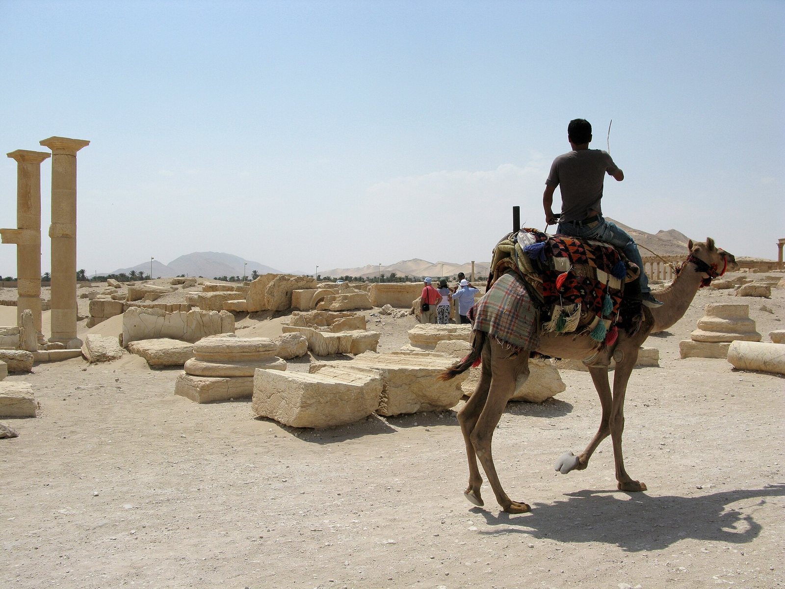
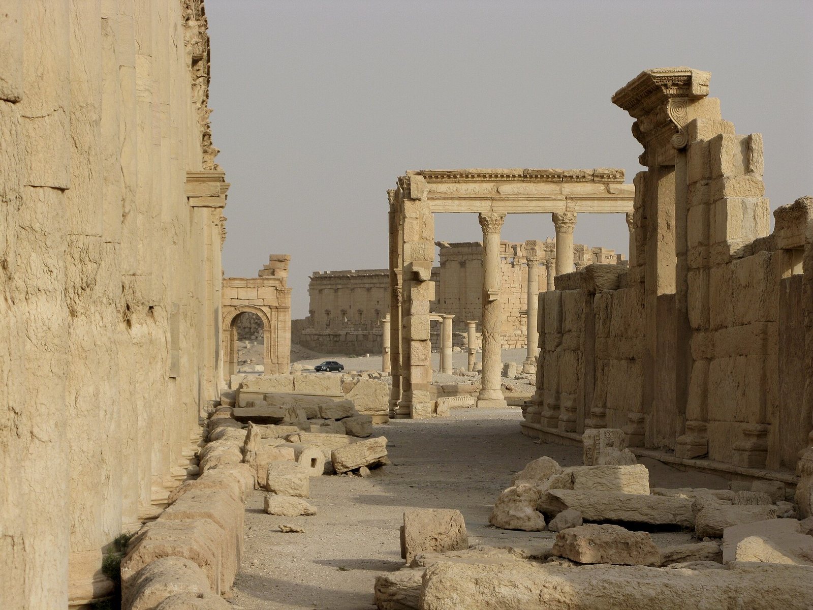
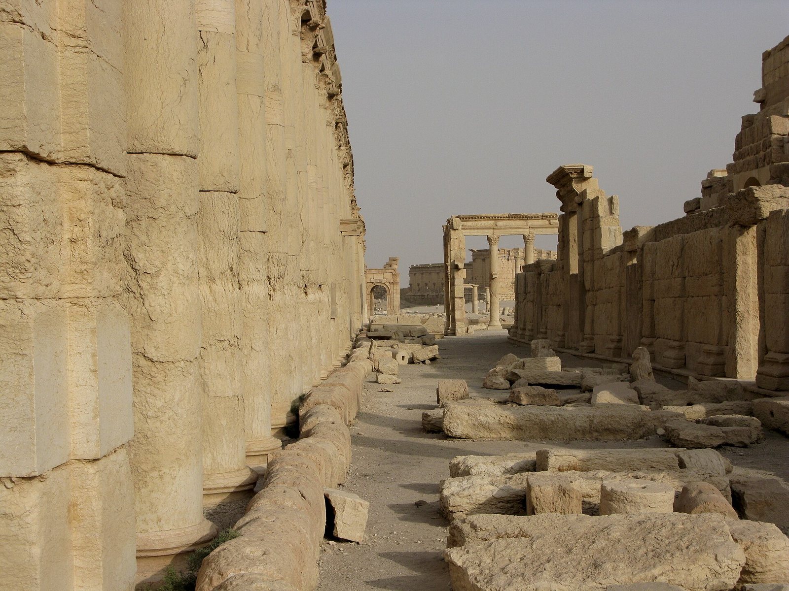
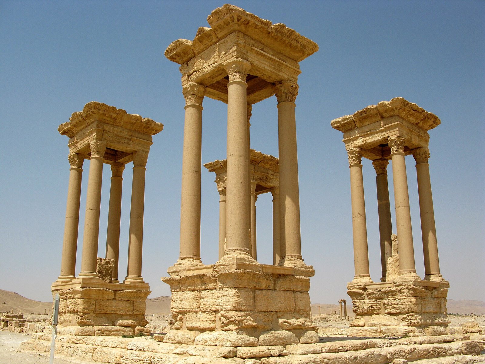
Photos: James Gordon — via Wikimedia Commons (CC BY) · Vyacheslav Argenberg — via Wikimedia Commons (CC BY)
Syria Trails — An interactive geographic and heritage atlas of Syria: a map that walks down from the country to the district, landmarks with their story and era, curated trails and a passport for your visits.