Nabataean Arch, Bosra
القوس النبطي في بصرى
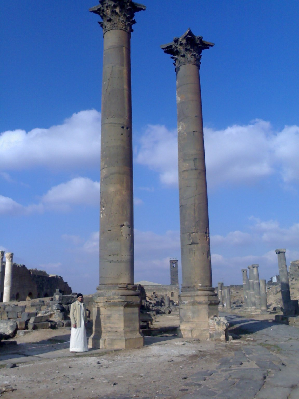
Monumental arch at the east end of Bosra's colonnaded street, from the period when Bosra was a Nabataean capital.
At the eastern end of Bosra's colonnaded street stands the Nabataean Arch, a key witness to the city's Nabataean phase. The Nabataeans, an Arab people whose capital was Petra, saw their last king, Rabbel II, move his seat to Bosra in the late 1st century AD.
The arch dates to that transitional time, the late 1st–early 2nd century, just before Rome annexed the kingdom as the Province of Arabia with Bosra as capital. Its distinctive Nabataean capitals differ from classical ones; a large opening is flanked by niches and engaged columns, probably a ceremonial entrance to a major complex.
In AD 106 Cornelius Palma, a general of Trajan, annexed the Nabataean kingdom, and Bosra became Nova Trajana Bostra, seat of the Roman governor. In Byzantine times it was an important archbishopric; the Muslims under Khalid ibn al-Walid took it in 634, and it remained the southernmost outpost of Bilad al-Sham and a stop for pilgrim caravans between Damascus and Mecca and Medina.
Built of black basalt and well preserved, it offers a rare view of Nabataean architecture outside Petra. Part of the Ancient City of Bosra World Heritage site.
Note: photos may not reflect the site's current condition.
For the visitor
Location: 32.5190, 36.4845 · Open on the map
Photos: User:Cyb3r — via Wikimedia Commons (Public domain)
Syria Trails — An interactive geographic and heritage atlas of Syria: a map that walks down from the country to the district, landmarks with their story and era, curated trails and a passport for your visits.